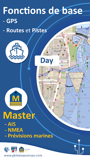
One app to meet all your fishing and boating needs, developed with the help of boating experts. Download the best nautical charts and with Aqua Map Master, turn your device into a real Chartplotter.
►► Features:
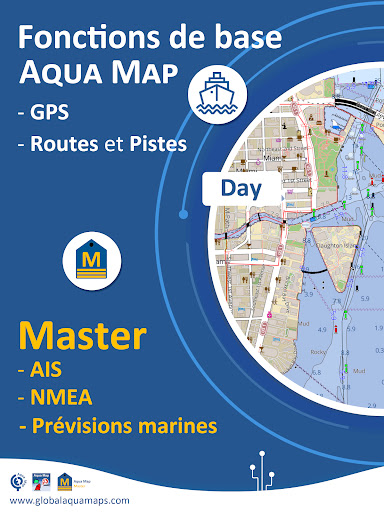
• Download maps to a device for offline use
• Plan and navigate your route with real-time information.
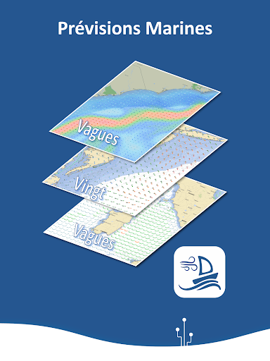
• Access the latest marine forecasts (wind, waves, currents, and weather)
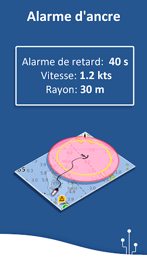
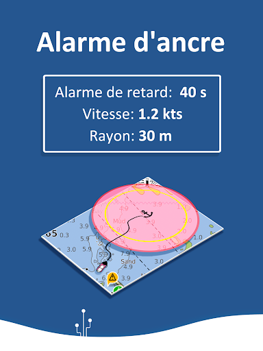
• Anchor alarm with advanced configuration
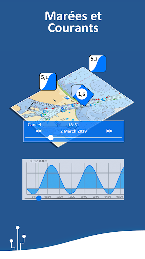
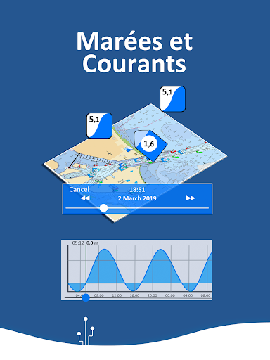
• Forecast and simulation of tides and currents (only in the United States and Canada)
• Share and load tracks, markers, and routes (KMZ and GPX)
• Connect with your friends using the Live Sharing feature
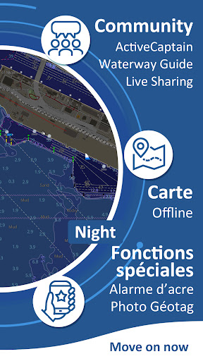
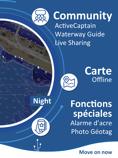
• ActiveCaptain & Waterway Guide community integration
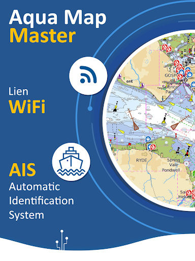
• Connect your NMEA devices
• Overlay USACE data (USA only)
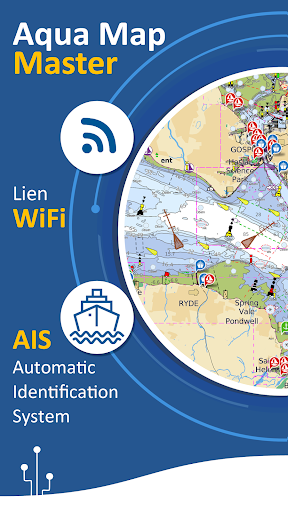
• View AIS information from external devices with automatic collision detection
• Overlay satellite images on your map
• Measure distances on the map
► MAPS
Aqua Map only uses official nautical charts with depth contours, buoys, lights, etc. You can download the maps at home to your device and use them offline on the boat (no other internet connection is required).
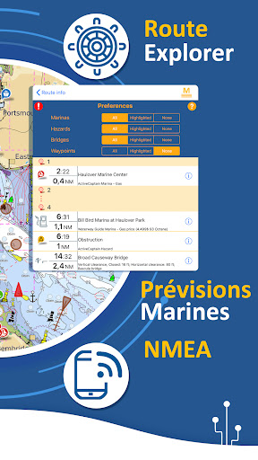
► ROUTES AND WAYPOINTS
Plan your trip, and insert and edit waypoints. Navigate your route and monitor the distance, time (ETA) and direction to your next waypoint or final destination.
► ANCHOR ALARM
This function will check your GPS position in real-time against your previously set anchor position. An audible and visual alarm is triggered as soon as your GPS position is outside the defined range.
► TIDES AND CURRENTS
You can calculate forecasts for over 7500 stations in the United States and, Canada, Bahamas and Australia. Visualize the T&C trend on the map and simulate a future date.
► UPLOAD and SHARE
You can share your favorite markers or send an email with your latest daily headline. Not only that, you can also load any KML, KMZ, GPX files (also compressed) found on the Internet or received from your friends.
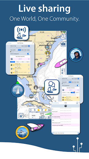
► LIVE SHARING
Activate the exchange of your data with the Aqua Map community and follow your favorite users on the screen. See all active users around you.
You can chat with them and send (and receive) your favorite routes/tracks/markers without leaving the Aqua Map app.
► Aqua Map Master
Access the latest marine forecasts.
Connect your NMEA devices via WiFi and use their data for all app functions (e.g. Anchor Alarm), view Route Explorer for bridges, hazards, and best fuel prices, view AIS targets on the map with automatic collision detection, download and view the latest USACE data (US only).
► ActiveCaptain
Join the community of over 100,000 boaters who write reviews, update data and provide up-to-date hazard and marina information.
► Waterway Guide
Marinas, hazards, anchorages, bridges, free docks and more to cover the entire US coastline.
► PURCHASE TYPE
- Unlimited: you can download and update your maps forever.
- Subscription: This is an automatically renewable one-year subscription. It will automatically renew unless auto-renew is turned off at least 24 hours before the end of the current period.
Conditions d\utilisation: http://www.globalaquamaps.com/Acknowledge.html
Confidentialité: http://www.gec-it.com/GEC-privacy.pdf